“…our ambition is to bring together the creativity and energy of Shoreditch and the incredible possibilities of the Olympic Park to help make East London one of the world’s great technology centres…in East London, we have the potential to create one of the most dynamic working environments in the world…we are today setting ourselves the ambition of making Britain the best place in the world for early stage and venture capital investment…Here’s our vision for East London tech city – a hub that stretches from Shoreditch and Old Street to the Olympic Park… [1].
David Cameron in East London, 4.11.2010
On 24 October 2010, two weeks before David Cameron gave his ‘vision of East London as a tech hub’ speech, the performance poet Robin Bale lead myself and three other participants on a walk around Shoreditch and Hoxton. He traced the invisible border that had been erected by the imposition of Hackney Council’s Alcohol Control Zones.

Alcohol Control Zones, also known as Designated Public Place Orders (DPPOs), give the police powers to stop people from drinking and to confiscate alcohol within a designated geographical area. In the words of the 2001 Criminal Justice and Police Act, a local authority can order the public; “(a) not to consume in that place anything which is, or which the constable reasonably believes to be, alcohol; (b) to surrender anything in his possession which is, or which the constable reasonably believes to be, alcohol or a container for alcohol …”[2]. The Act states that an offender will be “liable on summary conviction to a fine”. The fine can be a fixed penalty notice of £50 up to a maximum of £500.
The introduction of the Alcohol Control Zones immediately affected Hoxton’s street drinkers and rough sleepers, particularly around St-Anne’s church, Hoxton Community Gardens and Haggerston Park. In effect making the area a no-go zone for certain ‘undesirable’ members of the public. Robin’s original plan was to circumnavigate the Alcohol Control Zones, whilst drinking alcohol, in an attempt to observe what, in the environment, might have given rise to the measure [3].
I returned to this area again in March 2013 to witness another of Robin’s performances. This time Robin was performing a shamanic ‘cleansing’ of the area. He used chants of ‘Data, Money, Data’ and connected the rows of bottled water in Foxton’s faux-bar shop front with the river Walbrook which was believed to emerge from the sacred spring at the site of the former Holywell Priory. He berated the growth of local gyms, luxury flats and bars and exposed the ruins of the boroughs social housing. Since Robin’s original walk, the Alcohol Control zone had been extended to the whole of the borough of Hackney and the original Zone had now been re-branded as the Silicon Roundabout, not referring solely to the old street roundabout itself but to the digital cluster that, with the help of David Cameron, was now stretching in all directions from the roundabout.
The contrast this time was much more stark that in 2011. In 2011 it was clear that the desire of enacting the DPPO was to enhance the appeal of the area to young creative types by making the area ‘safer’ by eradicating the areas visible poor. Namely those who would meet to drink alcohol in the local parks or churchyards. This time the visible contrast produced by Robin’s performance was not between those members of the public who would sit outside bars drinking whilst those sitting and drinking in the parks were been harassed by the local constabulary. This time the contrast was between the large number of construction projects that were creating new luxury apartments whilst the area’s social housing was being under-invested, residents moved out, and whole working class housing estates demolished. Rows of derelict social housing lie side by side with new developments such as 145 city road, a 39 storey, 300 unit apartment block; 261 city road which will soon become a 36 storey residential tower; the 27 storey Eagle House and the 29 storey ‘Groveworld’ buildings.
Robins latest performance, ‘Data, Money Data’, highlights the direct relationship between the growth of Shoreditch as a Tech Hub and the Process of social cleansing that has been accelerated inline with government investment. His transformative and esoteric drift brought into sharp relief a sociospatial process that is having a massive impact on the land use of the inner city and has parallels in most post-industrial cities [4].
In many ways Shoreditch and Hoxton function as a metaphor for the wider industrial and economic shifts that have taken place since the end of the 1980’s. This area was a former industrial area that was hit hard by the decline and relocation of manufacturing and light industries. Leaving a proliferation of decaying former industrial properties and a high level of poverty and unemployment. The access to cheap industrial units attracted the 80’s artists associated with the YBA movement, reactivating these spaces initially into artist studios and galleries and eventually into bars, clubs and restaurants. However, the impoverished artists who created the Hoxton experience in the first place have also moved on because of the rise in property prices…’ [5]
What Robin’s performance suggests is that the area has taken a fundamental shift from “creative cluster” to what Saskia Sassen would recognise as a command and control node in the global network of economic exchange. Sassen has highlighted how the shift from industrial production to post-industrial knowledge and finance based production has lead to the dispersal of manufacturing, whilst creating new forms of centralisation which in turn producing new sociospatial configurations within the post industrial city.

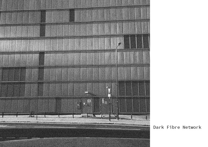
In order to coordinate and manage the complexity of dispersed production, a vast expansion of the communications infrastructure is required. So we can see that the practices of knowledge based production develop in tandem with the development of the Internet and fuel its’ convergence with other communications infrastructures such as Mobile phone networks and locatative media. Contrary to many of the early predictions outlining how the rapid growth of networked communications would change the nature of work, freeing people from the office and out of the crowded cities, the converse has occurred. The major cities of the world have re-emerged as important centres in the global network of economic flows. We can visualise their emergent role as centralised control and management nodes within the global network of production and exchange, employing a growing workforce of immaterial knowledge workers. Sassen observed that, advances in electronics and telecommunications have transformed geographically distant cities into centres of global communication and long distance management [6]. I think that Sassen here correctly identifies the emergence of centralised control within the chaotic network of distributed production. Whilst the vast expansion of the communications infrastructure has enabled the production process to become deterritorialised, the need to control the activities of distributed production has coalesced into centralised control nodes within global cities and Silicon Roundabout is one such node. The reterritorialisation of global cities has also started to reverse the decline of the inner-city residential districts. The process of deindustrialisation left many inner city areas with high levels of unemployment, poor housing and a population socially excluded from more prosperous districts. As the City remerges the location of these districts, often close to the business and financial centres of cities are once again becoming desirable places to live for the young knowledge and culture workers whose immaterial labour is required by the new economy of information and control. Consequently properties in these areas have become attractive to property speculation and overseas investment. Because of the disproportionate concentration of very high and very low income in these areas they are characterised, as Robin’s performance exposes, by economic and spatial polarisation. The effect of the regeneration of Shoreditch and Hoxton has been to raise property value and increase rents. This, combined with the governments’ Housing benefit cap expected to be introduced in the area from September 2013, is producing the conditions for a literal class cleansing of the area, as poorer families are priced out and forced to move further and further to the outskirts of the city or displaced to cheaper areas altogether.

On Thursday 6 December 2012 the Prime Minister and the Mayor of London announced plans to transform Old Street Roundabout. The Government will put £50m towards creating a new civic space. The new space will house classrooms, auditoriums, shared office space, and 3D printing technology. Prime Minister David Cameron said, “We’re investing in creating the largest civic space in Europe – a place for start-up companies and the local community to come together and become the next generation of entrepreneurs’. It is clear that if Robins visionary divinations of the area are correct and the class cleansing continues the ‘local community’ referred to by Prime Minister Cameron will be a very different ‘community’ from the one that is currently residing in the area.
Robin Bale 2013 – ‘They knocked down the estates or decided that market rents, and who makes the market, was more appropriate. They put the occupants in tracksuits and taxed their booz. Theirs a fear of contagion. Gyms sprung up like mushrooms, where those who could – could reduce their flesh – to work of the burden of self hood. Where they could reduce their meat – to reduce the burden of selfhood. Running to stay still. – And the only flows round here – Underground – Will be Data and Money. That which comes to the same thing – Underground – Data and Money’.
Notes
[1] David Cameron in East London, 4.11.2010, Transcription of speech: Retrieved from: http://www.number10.gov.uk/news/east-end-tech-city-speech/
[2] Criminal Justice and Police Act 2001, section 12, HM Government, 2001, http://www.legislation.gov.uk/ukpga/2001/16/section/12#commentary-c1772955 (accessed 25/02/11).
[3] Stated aim of the walk in: Bale, R (2012) “I know thee not, old man”: The Designated Public, In D.Naik & T.Oldfield, (Eds.), CRITICAL CITIES Volume 3, London, Myrdle Court Press
[4] Saskia, S. (2001). the Global City, p256, United Kingdom: Prinston University Press
[5] G. Evans and P. Shaw (January 2004). The Contribution Of Culture To Regeneration In The Uk: A Review Of Evidence, A report to the Department for Culture Media and Sport
[6] S. Sassen (1997). The New Centrality – The Impact of Telematics and Globalization. In P. Droege, Intelligent Environments: Spatial Aspects of the Information Revolution, MIT Press